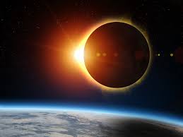
Satellite images from NASA and NOAA showed the total eclipse’s shadow from space.
A collaboration between NASA and NOAA has captured satellite images of the sky during the April 8 total solar eclipse.The total solar eclipse swept across North America on Monday, passing over Texas. Despite Visibility Concern, the weather cooperated, and the skies cleared up in many parts of the Dallas-Fort Worth area in time for the totality.
The perfect satellite view comes from the Geostationary Operational Environmental Satellite-R (GOES), a collaboration between NASA and NOAA. According to product documentation, this GeoColor imagery allows for an intuitive interpretation of meteorological and surface-based features. The images use a true color technique for satellite imagery to provide a view from space as close as the human eye would sesee
“The incredible True color provides a visually intuitive baseline and training aid for the interpretation of other false color enhancements, as well as an effective means to communicate satellite imagery to the public,” the algorithm’s paper reads.

This technology was used in the past to follow the path of the total solar eclipse of Aug. 21, 2017, in which the path of totality crossed the U.S. coast-to-coast transversely from Oregon to South Carolina.